GEOLOGY AND VEGETATION AT NELLIE JUAN GLACIER


Scroll down or click on the map below to learn about the geology and vegetational succession at Nellie Juan glacier.  Each red number links to a photo.


1.  This granitic dome is about four miles northwest of Nellie Juan lagoon and is part of the Oligocene Nellie Juan pluton.  Exfoliation along sheeting joints is responsible for the broad rounded surfaces on this peak.  Taylor Glacier in Kings Bay with its prominent medial moraines is visible in the background.
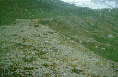
2.  This view shows open parkland on the north side of the bedrock knob shown in photo 3 of the flyover tour.  Muskeg has developed over shallow granitic bedrock while mountain hemlock (Tsuga mertensiana) grows in isolated clusters and stands.  This area was beyond the limits of the most recent ice advance and is typical of areas around western Prince William Sound where muskeg and forest growth has been uninterrupted by geologic processes for millennia.
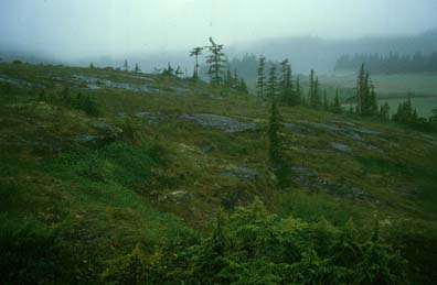
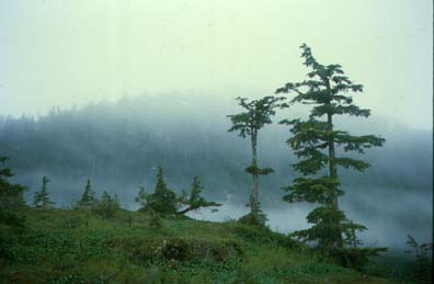
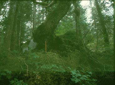
3.  This closer view of mountain hemlock shows the typical layered growth form of these conifers when mature.  Several trees cored on this bedrock knob were over 600 years old.


4.  This twisted tree was partially buried in the terminal moraine when Nellie Juan Glacier reached its maximum extent from the 1840s to 1880s.  Tree-rings show that this tree was responding to this damage from 1877 to 1884.  This photo also shows the closed-canopy first generation forest that is growing in the deglaciated areas near the terminal moraine.  Photo taken by Greg Wiles, 1992.
5.  This kame terrace was deposited on the eastern side of Nellie Juan lagoon during retreat of the ice during the 20th century.  This landform developed when the glacier filled the right side of this view and gravel and sand carried by meltwater accumulated between the ice and the mountainside (left side of view).  Jim (in yellow) is sitting at the point where the ice surface met the terrace surface.
6.  This is the main sampling gully on the east side of the lagoon where we found most of the subfossil logs (there are a few of these logs in the foreground).  The gully has been eroded through a terrace of till and kame deposits, visible in the gully wall on the far side of the stream.  The boulders in the foreground are a lag left behind after the stream washed away the enclosing gravel, sand and finer sediment.  Young thickets of head-high alders are visible on the top surface of the terrace.
7.  The areas closest to the present Nellie Juan terminus have almost no vegetation because they have only been deglaciated for the past few decades.  A few small alders are the first significant vegetation to begin to grow in this area.  Much of this land is barren rock and so is a poor substrate for vegetation.  Also, the inner areas of the fjord are several miles from suitable seed sources and this separation of seed and substrate is also a factor in the lack of vegetation in this area.


  Return to Nellie Juan index page.